Home > Europe > United Kingdom > England > London > Boroughs > Camden
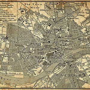
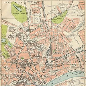
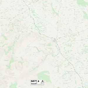
Newcastle NE2 1 Map

![]()
Wall Art and Photo Gifts from Map Marketing
Newcastle NE2 1 Map
Postcode Sector Map of Newcastle NE2 1
Media ID 19976143
Albert Street Barker Street Boyd Street Byron Street Camden Street Chester Street Churchill Gardens Clarence Street Coppice Way Doncaster Road Field Close Fore Street Gladstone Place Gladstone Terrace Grantham Road Granville Gardens Granville Road Greystoke Avenue Greystoke Gardens Grosvenor Gardens Harrison Place Helmsley Road Jesmond Road Kelvin Grove Lansdowne Gardens Milton Close Milton Place Napier Street Newcastle Osborne Terrace Portland Road Rock Terrace Selborne Gardens Springbank Road Union Street Victoria Mews Victoria Square Wesley Street Bermondsey Street
FEATURES IN THESE COLLECTIONS
> Europe
> United Kingdom
> England
> London
> Boroughs
> Camden
> Europe
> United Kingdom
> England
> Northumberland
> Amble
> Europe
> United Kingdom
> England
> Northumberland
> Beadnell
> Europe
> United Kingdom
> England
> Northumberland
> Related Images
> Europe
> United Kingdom
> England
> Northumberland
> Rock
> Europe
> United Kingdom
> Northern Ireland
> County Down
> Newcastle
> Map Marketing
> Postcode Sector Maps
> NE - Newcastle upon Tyne
> Maps and Charts
> Related Images
MADE IN THE USA
Safe Shipping with 30 Day Money Back Guarantee
FREE PERSONALISATION*
We are proud to offer a range of customisation features including Personalised Captions, Color Filters and Picture Zoom Tools
SECURE PAYMENTS
We happily accept a wide range of payment options so you can pay for the things you need in the way that is most convenient for you
* Options may vary by product and licensing agreement. Zoomed Pictures can be adjusted in the Cart.