Home > Aerial Photography > Related Images
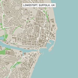
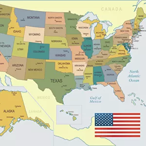
Rock Springs Wyoming US City Street Map

![]()
Wall Art and Photo Gifts from Fine Art Storehouse
Rock Springs Wyoming US City Street Map
Vector Illustration of a City Street Map of Rock Springs, Wyoming, USA. Scale 1:60, 000.
All source data is in the public domain.
U.S. Geological Survey, US Topo
Used Layers:
USGS The National Map: National Hydrography Dataset (NHD)
USGS The National Map: National Transportation Dataset (NTD)
Unleash your creativity and transform your space into a visual masterpiece!
Frank Ramspott
Media ID 15054941
© Frank Ramspott, all rights reserved
Aerial View City Map Computer Graphic Directly Above Downtown District Gray Road Map Text Wyoming Digitally Generated Image Green Color White Color
FEATURES IN THESE COLLECTIONS
> Aerial Photography
> Related Images
> Animals
> Insects
> Hemiptera
> Green Scale
> Arts
> Contemporary art
> Digital artwork
> Street art
> Arts
> Landscape paintings
> Waterfall and river artworks
> River artworks
> Arts
> Portraits
> Pop art gallery
> Street art portraits
> Arts
> Street art graffiti
> Digital art
> Digital paintings
> Arts
> Street art graffiti
> Digital art
> Vector illustrations
> Fine Art Storehouse
> Map
> Street Maps
> Fine Art Storehouse
> Map
> USA Maps
> Maps and Charts
> Geological Map
> Maps and Charts
> Related Images
> North America
> United States of America
> Lakes
> Related Images
EDITORS COMMENTS
This print showcases a detailed and intricately designed city street map of Rock Springs, Wyoming, USA. With a scale of 1:60,000, this vector illustration provides an accurate representation of the downtown district, complete with its charming lake and river. The roads are clearly marked, allowing viewers to navigate through the city effortlessly. The source data used for this masterpiece is in the public domain and comes from reputable sources such as the U. S. Geological Survey (USGS) and their National Map datasets. Specifically, the National Hydrography Dataset (NHD) and National Transportation Dataset (NTD) were utilized to create this visually stunning piece. Created by talented artist Frank Ramspott using computer graphics technology, this digitally generated image offers an aerial view directly above Rock Springs. The color palette includes shades of gray, blue, white, and green that beautifully complement each other. With no people present in the image itself, all attention is drawn towards the intricate cartography displayed on this print. Perfect for enthusiasts of geography or those with a connection to Rock Springs' vibrant community spirit - whether you're a resident or simply have fond memories of visiting - this artwork will surely add character to any space it graces.
MADE IN THE USA
Safe Shipping with 30 Day Money Back Guarantee
FREE PERSONALISATION*
We are proud to offer a range of customisation features including Personalised Captions, Color Filters and Picture Zoom Tools
SECURE PAYMENTS
We happily accept a wide range of payment options so you can pay for the things you need in the way that is most convenient for you
* Options may vary by product and licensing agreement. Zoomed Pictures can be adjusted in the Cart.