Home > Arts > Artists > B > John Brown
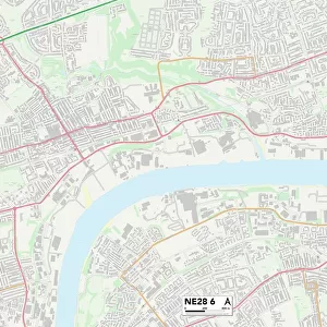
Northumberland NE22 7 Map

![]()
Wall Art and Photo Gifts from Map Marketing
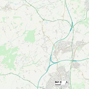
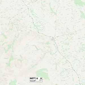
Northumberland NE22 7 Map
Postcode Sector Map of Northumberland NE22 7
Media ID 19975414
Albert Road Arundel Close Barrington Road Blenheim Drive Burnside Cedar Close Cherry Tree Drive Clayton Street Court Road East Crescent Edward Road Farriers Court Fountain Close George Road Grange Avenue Grange Park Avenue Greenwood Avenue Kings Road Melrose Court Moorland Avenue Moorland Crescent Moorland Drive Northfield Northumberland Oakapple Close Palace Road Park Avenue Park Terrace Parkside Queens Road Rowan Close Sandfield Road School Road St Johns Crescent St Johns Place St Johns Road Stephenson Way The Willows Welwyn Avenue West Road West View Wilson Avenue Yew Tree Drive Bomarsund Carisbrooke
FEATURES IN THESE COLLECTIONS
> Arts
> Artists
> B
> John Brown
> Arts
> Artists
> B
> John George Brown
> Arts
> Artists
> G
> John Greenwood
> Arts
> Artists
> V
> Georges Villas
> Arts
> Artists
> W
> Wilson Wilson
> Europe
> United Kingdom
> England
> Northumberland
> Belsay
> Europe
> United Kingdom
> England
> Northumberland
> Red Row
> Europe
> United Kingdom
> England
> Northumberland
> Related Images
> Europe
> United Kingdom
> Heritage Sites
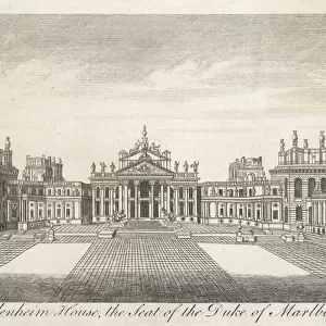
> Blenheim Palace
> Europe
> United Kingdom
> Scotland
> Scottish Borders
> Melrose
> Map Marketing
> Postcode Sector Maps
> NE - Newcastle upon Tyne
MADE IN THE USA
Safe Shipping with 30 Day Money Back Guarantee
FREE PERSONALISATION*
We are proud to offer a range of customisation features including Personalised Captions, Color Filters and Picture Zoom Tools
SECURE PAYMENTS
We happily accept a wide range of payment options so you can pay for the things you need in the way that is most convenient for you
* Options may vary by product and licensing agreement. Zoomed Pictures can be adjusted in the Cart.