Home > Arts > Art Movements > Landscapes
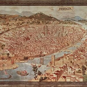
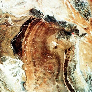
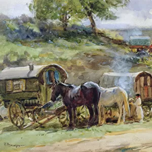
Map of Florence, 15th century

![]()
Wall Art and Photo Gifts from Heritage Images
Map of Florence, 15th century
Map of Florence, 15th century. Pictorial Italian map showing the layout of the city. From the Gallery of Maps, Vatican Museum, Rome
Heritage Images features heritage image collections
Media ID 14866362
© Art Media / Heritage-Images
Cartography Community Distance Duomo Environment Florence Florentine High Angle Illustration And Painting Information Map Making Plan Tuscany
FEATURES IN THESE COLLECTIONS
> Arts
> Art Movements
> Landscapes
> Arts
> Art Movements
> Medieval Art
> Arts
> Art Movements
> Renaissance Art
> Arts
> Landscape paintings
> Landscape art
> Landscape paintings
> Arts
> Landscape paintings
> Landscape art
> Arts
> Landscape paintings
> Rural countryside paintings
> Country landscapes
> Arts
> Landscape paintings
> Rural countryside paintings
> Landscape paintings
> Arts
> Landscape paintings
> Rural countryside paintings
> Arts
> Landscape paintings
> Waterfall and river artworks
> Landscape paintings
> Arts
> Landscape paintings
> Waterfall and river artworks
MADE IN THE USA
Safe Shipping with 30 Day Money Back Guarantee
FREE PERSONALISATION*
We are proud to offer a range of customisation features including Personalised Captions, Color Filters and Picture Zoom Tools
SECURE PAYMENTS
We happily accept a wide range of payment options so you can pay for the things you need in the way that is most convenient for you
* Options may vary by product and licensing agreement. Zoomed Pictures can be adjusted in the Cart.