Home > Maps and Charts > Related Images
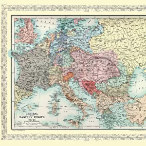
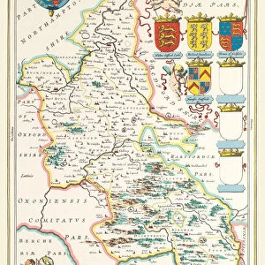
Two Maps of Central Europe that illustrate how the region looked during the years of conflict between AD 1804 and AD 1809

![]()
Wall Art and Photo Gifts from MapSeeker
Two Maps of Central Europe that illustrate how the region looked during the years of conflict between AD 1804 and AD 1809
EHIST012
Welcome to the Mapseeker Image library and enter an historic gateway to one of the largest on-line collections of Historic Maps, Nostalgic Views, Vista's and Panorama's from a World gone by.
Media ID 20348276
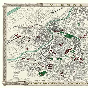
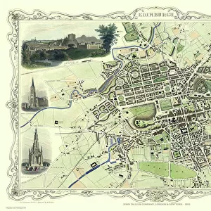
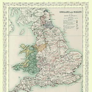
Europe Europe Map Map Of Europe
FEATURES IN THESE COLLECTIONS
> Maps and Charts
> Related Images
> MapSeeker
> Maps of Europe
> Old Maps of Europe and Small Islands of
MADE IN THE USA
Safe Shipping with 30 Day Money Back Guarantee
FREE PERSONALISATION*
We are proud to offer a range of customisation features including Personalised Captions, Color Filters and Picture Zoom Tools
SECURE PAYMENTS
We happily accept a wide range of payment options so you can pay for the things you need in the way that is most convenient for you
* Options may vary by product and licensing agreement. Zoomed Pictures can be adjusted in the Cart.