Home > Europe > United Kingdom > England > London > Boroughs > Croydon
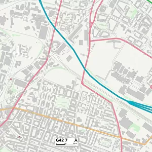
Croydon SE19 2 Map

![]()
Wall Art and Photo Gifts from Map Marketing
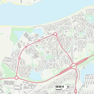
Croydon SE19 2 Map
Postcode Sector Map of Croydon SE19 2
Media ID 19981778
Acorn Gardens Alma Place Auckland Close Auckland Road Belvedere Road Brunel Close Brunswick Place Church Road Clovelly Gardens Copper Close Croydon Fox Hill Hamlet Road High View High View Close Lansdowne Place Milestone Road Mowbray Road Palace Road Stoney Lane Sylvan Road Telford Close The Dell Tudor Road Waldegrave Road Palace Square
FEATURES IN THESE COLLECTIONS
> Asia
> Turkey
> Related Images
> Europe
> United Kingdom
> England
> London
> Boroughs
> Croydon
> Map Marketing
> Postcode Sector Maps
> SE - London SE
> Maps and Charts
> Related Images
> Popular Themes
> Brunel
MADE IN THE USA
Safe Shipping with 30 Day Money Back Guarantee
FREE PERSONALISATION*
We are proud to offer a range of customisation features including Personalised Captions, Color Filters and Picture Zoom Tools
SECURE PAYMENTS
We happily accept a wide range of payment options so you can pay for the things you need in the way that is most convenient for you
* Options may vary by product and licensing agreement. Zoomed Pictures can be adjusted in the Cart.