Home > Europe > United Kingdom > Scotland > Lothian > Dalkeith
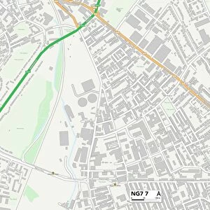
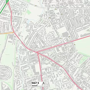
Nottingham NG7 5 Map

![]()
Wall Art and Photo Gifts from Map Marketing
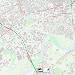
Nottingham NG7 5 Map
Postcode Sector Map of Nottingham NG7 5
Media ID 19976016
Addington Road Bakers Close Brown Street Chadwick Road Churchfield Lane Cope Street Court Street Craven Road Darley Avenue Darley Road Dorking Road Fleet Close Grimston Road Grundy Street Hazelwood Road Holland Street Hubert Street Lambert Street Millers Court New Road Nottingham Oakland Street Osborne Street Pleasant Row Prospect Street Prospect Terrace Radford Road St Pauls Avenue St Pauls Terrace The Poplars Ward Street Woodstock Avenue Wordsworth Road
FEATURES IN THESE COLLECTIONS
> Arts
> Artists
> H
> Hubert Hubert
> Arts
> Artists
> R
> Paul Rand
> Europe
> United Kingdom
> Scotland
> Lothian
> Dalkeith
> Europe
> United Kingdom
> Wales
> Flintshire
> Hawarden
> Europe
> United Kingdom
> Wales
> Powys
> Knighton
> Map Marketing
> Postcode Sector Maps
> NG - Nottingham
> Maps and Charts
> Related Images
MADE IN THE USA
Safe Shipping with 30 Day Money Back Guarantee
FREE PERSONALISATION*
We are proud to offer a range of customisation features including Personalised Captions, Color Filters and Picture Zoom Tools
SECURE PAYMENTS
We happily accept a wide range of payment options so you can pay for the things you need in the way that is most convenient for you
* Options may vary by product and licensing agreement. Zoomed Pictures can be adjusted in the Cart.