Home > Asia > China > Maps
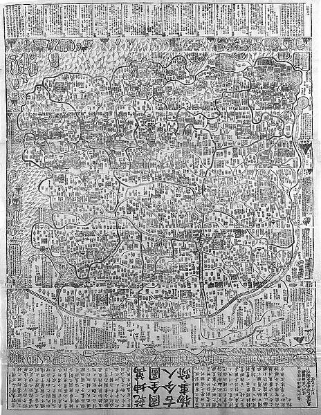
Chinese map of the World including information taken to China by the Jesuit missionaries
![]()

Wall Art and Photo Gifts from Heritage Images
Chinese map of the World including information taken to China by the Jesuit missionaries
Chinese map of the World including information taken to China by the Jesuit missionaries. Based on Matteo Riccis lost map of 1584
Heritage Images features heritage image collections
Media ID 14847816
© Ann Ronan Picture Library / Heritage-Images
Cartography Discovery Exploration Map Making Ricci World World Map Ann Ronan Pictures Matteo
FEATURES IN THESE COLLECTIONS
EDITORS COMMENTS
This print showcases a remarkable piece of history - the Chinese map of the World, enriched with knowledge brought to China by Jesuit missionaries. Created by Matteo Ricci in 1584, this lost map has been beautifully preserved and reproduced for us to marvel at today. In an era marked by exploration and discovery, this map stands as a testament to human curiosity and the thirst for knowledge. It reflects the global perspective of the Chinese people during the 16th century, highlighting their understanding of geography and cartography. The vibrant colors used in this print bring life to every corner of the world depicted on it. From distant lands across vast oceans to familiar countries closer to home, each location is meticulously detailed. This masterpiece not only serves as a visual representation but also provides valuable insights into how different cultures perceived our planet centuries ago. Matteo Ricci's contribution cannot be overstated; his efforts in bridging East and West allowed for an exchange of ideas that greatly influenced Chinese cartography. Through his collaboration with local scholars, he was able to incorporate new information into this comprehensive world map. As we gaze upon this extraordinary print, we are reminded of humanity's endless quest for knowledge and understanding. It serves as a reminder that exploration knows no boundaries - whether geographical or cultural - and that even centuries-old maps can still inspire awe and wonder today.
MADE IN THE USA
Safe Shipping with 30 Day Money Back Guarantee
FREE PERSONALISATION*
We are proud to offer a range of customisation features including Personalised Captions, Color Filters and Picture Zoom Tools
SECURE PAYMENTS
We happily accept a wide range of payment options so you can pay for the things you need in the way that is most convenient for you
* Options may vary by product and licensing agreement. Zoomed Pictures can be adjusted in the Cart.

